 Asking for opinions on the best roads in a region is like asking a group of riders about the best oil for a bike or where to find the best BBQ. You can count on those discussions to generate plenty of heat and very little light.
In Motorcycle Journeys, I shied away from naming any particular road as "the best," in part because I'd have worn out the label after a while. So many roads throughout the Appalachians are worthy of a "best" designation in some respect, it's impossible to single out just one. There are roads featuring the best views, best curves, loneliest roads, prettiest highways, most entertaining, most historic, some best for hard riding, others best for laid-back touring, and so on.
That said, I spent a little time putting together a route through a portion of the eastern mountains that includes as many of these attributes as possible. I'd like to share that with you now so that as you make plans for next year's riding, you'll consider adding this to your "must ride" list.
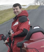
Harrisonburg, Virginia is the starting point for this tour. Centrally located in the Shenandoah Valley, Harrisonburg is a town whose fortunes have risen along with the growth of James Madison University. Even though Harrisonburg is growing rapidly, its rural roots are still visible, whether you're dining in a local downtown restaurant or following an Old Order Mennonite out of town in their horse and buggy. On a hot, muggy day in July or August, you'll likely note a certain acrid aroma in the air, a reminder that you are in one of the largest poultry regions of the country. Chicken. It's what's for dinner.
Harrisonburg's expansion is evident for a few miles as you head west on US 33. Once clear of Dale Enterprise, the suburbs give way to long stretches of heavily forested roads leading to the base of Shenandoah Mountain. Don't be surprised if a few road rockets catch up to you. The upcoming section of US 33 is widely recognized for its clean, tight curves and long vistas into West Virginia. At the summit, it's worth stopping for a minute or two, especially on a clear day. As far as you can see, the terrain is a series of unending ridges. Look what's ahead of you! Following this route, you'll be spending the entire day traversing those ridges!
On the back side of Shenandoah Mountain you'll pass through Brandywine. US 33 continues off to the north if you turn right. Instead, hang a left onto Sugar Grove Road, CR-21. This road threads through a small river valley, passing a Naval communication center. Flat, tight curves chase innumerable streams running through a narrow plain flanked by ridges. Sugar Grove, a collection of a few houses, a couple dilapidated buildings, a store and a church appears, backed up against a mountain ridge. In Sugar Grove, follow the sign pointing "To US 220" to enter Moyers Gap Road.
 Moyers Gap and the back roads to follow bring me some of my greatest riding pleasure. These little known routes traverse a part of the country seen by few and inhabited by fewer. Over the years, this remote region of Virginia and West Virginia has evolved into high pasture and wild meadows rivaling the majesty of many better known landscapes. You'll find wide swaths of open meadows laced with meandering brooks, all highlighting broad shouldered mountains capped with mixed hardwoods and evergreens. Had The Sound of Music been filmed on American soil, this could have been the setting. On more than one occasion I have stopped for a half hour or more to absorb the view and enjoy the solitude. It's not like I'm holding up traffic.
At US 220, turn south for a few miles, then right on Snowy Mountain Road, CR-17. Though they are separate routes, I think of Moyers Gap and Snowy Mountain as one. At times I have considered renaming this the "Philsopher's Road" because as I ride along this route, I can't help but think about some of life's big questions. I'm sure everyone has an idea of what heaven looks like. As for me, I hope it looks like this. Often, the mountain landscape looks rugged and wild. Here the open fields and craggy hills feel warm and inviting like a friend's embrace. Some have compared this area to the Scottish highlands or the Swiss alpine region. I'm not sure about the Alps, but it's no exaggeration to say that along Snowy Mountain Road you'll feel like you're riding in the hand of God.
After an endorsement like that, how can another road top Snowy Mountain? Not to worry, we're just getting warmed up. If Snowy Mountain Road appealed to your good nature, Route 28 is likely to inspire the devil in you. After a sedate tour on twisty back lanes, Route 28's wide and smooth pavement will incite you to wick it up a couple of notches. Long, fast sweepers will tempt you to discover the limits of lean angle. Just remember - this is Bambi's Woods. They may be cute (to some), but deer have yet to figure out the consequences of an ill-timed dash across the road. It's not likely they will do so in our lifetime.
When WV 28 catches up to US 250, follow it west to Bartow. If you're ready for a bite to eat, or if you got a late start and are at day's end, The Hermitage is a great spot to both grab a bit or get a room. The motel, built in '65 is situated along the Greenbrier River on seven acres. There's easy access to the river right behind the motel where you can spend hours horsing around in the shallows, look for crayfish, or skip rocks. The Hermitage was recently purchased by the owners of the Highland Inn in Monterey, Virginia, and they've done a great job breathing new life into this classic 60's motel. Ask for a top level room in the back and you can while away the evening on a long porch overlooking the Alleghenies.
A little farther down 28/92 is another popular stop for riders, the Boyer Motel, Restaurant and Campground. Boyer Restaurant features many dishes that are their own creation, including their own salad dressing recipe. The campground hosts the West Virginia GWRRA Goldwing chapter each August. Next along the road is the Green Bank Observatory. This was constructed to advance the science of radio astronomy and located in this remote valley due to the absence of terrestrial radio signals. If you have the time, it's worth the time spent for a tour of the facility. The 100 meter Green Bank Telescope is especially impressive. The 100 meter dish is the world's largest fully-steerable scope and features an unblocked surface, allowing radiation to meet the surface directly. It replaced a 300 foot scope that toppled in 1988 when a key support girder failed.
Just south of Greenbank is WV 66, another narrow country lane that carries you to US 219 by way of Cass and Snowshoe Mountain. As I've written before, Cass is a great weekend destination, and another good place to put up for the night. If you have just an hour or two, it's worth visiting the railroad station and general store at Cass. If you have more time, take a ride on one of the restored Shay locomotives. These coal-fired beasts were once used to haul lumber from the steep inclines and tight bends of track along Cheat Mountain. Now they serve as a tourist attraction in their own right, hauling passengers up and down these scenic slopes. These mechanized wonders are as much fun to watch at work as the ride up the mountain. For as many times as I've ridden the rails at Cass, I still look forward to sitting in the car closest to the engine where I can smell the sulfur-rich coal and feel the heat it releases as it turns water into steam into motion.
Continue down WV 92 to the intersection with WV 39 at Minehaha Springs. Turn east on 39 and prepare for another splendid ride. I often hear from readers who've traveled the routes I've laid out, but one in particular comes to mind on Route 39. The writer, a long-time resident of the western states made the remark that Route 39 compared with anything he has ridden in the West. Strong words, but I am inclined to agree. Warm Springs is a good spot to consider your options. If you're ready to begin your trek back to Harrisonburg or need to call it quits for the day, you're in the right place. You'll find a wide variety of small inns and B&Bs in the Warm Springs/Hot Springs area. You're also not far from Monterey, Virginia, another great rider's respite just twenty minutes up US 220. On the other hand, if you're thirsty for more, some of the most challenging mountain roads are yet to be ridden.
Heading east on 39 out of Warm Springs, the road makes a rapid ascent leading to a turnout marking the point where a toll house once stood. Scenic vistas appear along 39 with little or no shoulder offering a safe place to park, so this is a welcome spot to stop for a few pictures. Follow VA 39 to Goshen, then north on VA 42 to Churchville, then west on US 250. Like US 33, the next 35 miles to Monterey will challenge you with a series of ridge passes featuring dozens of tight switchbacks and peg-scraping sweepers. But wait, there's more!
The last 65 miles of the route features a great stretch of US 220 from Monterey to Franklin. Unlike east-west routes, US 220 follows the western edge of the Monterey Valley, resulting in a road with few elevation changes, but an unending series of fast sweepers that are simply a blast to ride. (For your broader planning purposes, try riding US 220 from Covington, VA into western Maryland some time. You won't regret it.) At Franklin, turn east on US 33 for the final run back to Harrisonburg.
I haven't really said enough about routes like US 219, riding through Bluegrass, WV 72, or following WV 28 to Seneca Rocks. You'll just have to come visit this area for yourself and plan to spend a few days riding in different directions. I have yet to find a back road in this region of the country that doesn't consistently deliver an A+ riding experience. In 60,000 square miles, that's saying something.